
Sella & Relleu Circuit
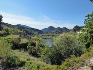
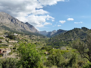
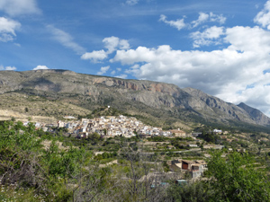
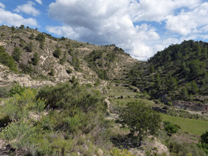
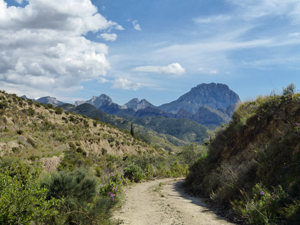
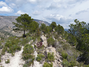
A very pleasant walk in the Sella/Relleu countryside. Dramatic views especially on the higher route from Relleu to Sella from which the entire range from Aitana to Campana and on to the sea being particularly good. Mostly good tracks with a few mule tracks, one semi scramble up bancales and a very short section of road. Note:Could be muddy within 1/2 days of rain.
Spanish maps included within these descriptions are provided courtesy of the Spanish IGN and remain © Instituto Geográfico Nacional.
OSM (OpenStreetMap) and OCM (OpenCycleMap) maps are © OpenStreetMap Contributors. The OSM project welcomes contributions from all to enrich the map data, which is made freely available. Land (Thunderforest Landscape) maps are © Thunderforest based on data © OpenStreetMap contributors.
The grade of this walk is MS/B, which means
MS – Moderately Strenuous: Up to 600 metres ascent and/or no more than 15 km in length with some rough going taken at a reasonable pace.
B – Less than half the route on rough ground
| Nearest town | Sella |
| Directions to start |
Approaching Sella by the CV-770 from the south, cross the bridge and go up to the final hairpin at the edge of the village, turn right onto a side road to car parks (signed) on the right in about 200m. From the north, drive through the village and just as you leave it turn left onto the side road as described above, to car parks on the right. |
| Start point (Lat/Long) | 38.608800, -0.269640 Click here to view in Google Maps (in a new browser tab) |
| Length (km) | 10.50 |
| Ascent (metres) | 440 |
| Walking time (hours) | 2.75 |
| Total time (hours) | 4 |
| Recommendations or Restrictions | None |
Download walk descriptionDownload GPS file
Comments
Sella & Relleu Circuit — No Comments
HTML tags allowed in your comment: <a href="" title=""> <abbr title=""> <acronym title=""> <b> <blockquote cite=""> <cite> <code> <del datetime=""> <em> <i> <q cite=""> <s> <strike> <strong>