
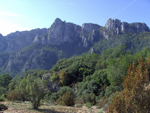
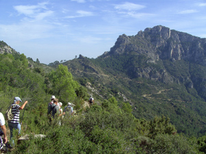
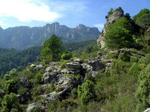
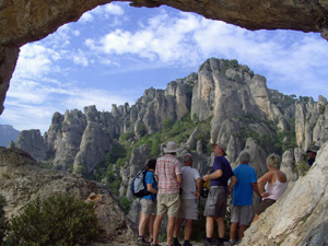
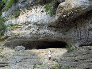
Font del Paradis
A pleasant walk partly through forest with good views of the rocky outcrops on the ridges and widening views later in the day.
Spanish maps included within these descriptions are provided courtesy of the Spanish IGN and remain © Instituto Geográfico Nacional.
OSM (OpenStreetMap) and OCM (OpenCycleMap) maps are © OpenStreetMap Contributors. The OSM project welcomes contributions from all to enrich the map data, which is made freely available. Land (Thunderforest Landscape) maps are © Thunderforest based on data © OpenStreetMap contributors.
The grade of this walk is S/B, which means
S – Strenuous: More than 600 metres ascent and/or more than 15km in length with steep, loose or heavily vegetated sections.
B – Less than half the route on rough ground.
| Nearest town | Mas de Barberans |
| Directions to start |
Take the TV 3421 south of the village and turn R into the Cami del Barranc de la Galera singposted to La Vall. (between km12 and 13 from La Senia) Continue as the road deteriorates to a track. It passes a signboard at the Raco d’en Marc. Several km further there is a sign down to the L and the car park area with BBQ, tables and so on. |
| Start point (Lat/Long) | 40.751565, 0.321286 Click here to view in Google Maps (in a new browser tab) |
| Length (km) | 12.00 |
| Ascent (metres) | 650 |
| Walking time (hours) | 3.50 |
| Total time (hours) | 5.00 |
| Recommendations or Restrictions |
Download walk descriptionDownload GPS file
Comments
Font del Paradis — No Comments
HTML tags allowed in your comment: <a href="" title=""> <abbr title=""> <acronym title=""> <b> <blockquote cite=""> <cite> <code> <del datetime=""> <em> <i> <q cite=""> <s> <strike> <strong>