
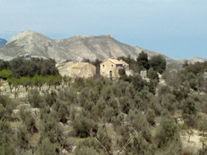
Los Tres Pueblos
A circular walk linking Tollos, Alcala de la Jovada and Beniaia. Mainly on tracks, some quiet roads, a short distance on a mozarabic path and a short defined path. Wonderful views.
Spanish maps included within these descriptions are provided courtesy of the Spanish IGN and remain © Instituto Geográfico Nacional.
OSM (OpenStreetMap) and OCM (OpenCycleMap) maps are © OpenStreetMap Contributors. The OSM project welcomes contributions from all to enrich the map data, which is made freely available. Land (Thunderforest Landscape) maps are © Thunderforest based on data © OpenStreetMap contributors.
The grade of this walk is VS/A, which means
VS – Very Strenuous: More than 800 metres ascent and/or more than 20km in length with steep, loose or heavily vegetated sections.
A – All on good tracks
| Nearest town | Tollos |
| Directions to start |
Take the CV720 through Castell de Castells and past Famorca, Facheca and soon afterwards there is a turn to the right to the village of Tollos. Take this and just before reaching the village park on the right in the car park behind a small recreation area. |
| Start point (Lat/Long) | 38.755890, -0.274300 Click here to view in Google Maps (in a new browser tab) |
| Length (km) | 21.00 |
| Ascent (metres) | 550 |
| Walking time (hours) | 4.50 |
| Total time (hours) | 6.00 |
| Recommendations or Restrictions |
Download walk descriptionDownload GPS file

Comments
Los Tres Pueblos — No Comments
HTML tags allowed in your comment: <a href="" title=""> <abbr title=""> <acronym title=""> <b> <blockquote cite=""> <cite> <code> <del datetime=""> <em> <i> <q cite=""> <s> <strike> <strong>