
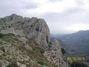
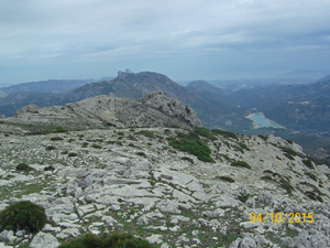
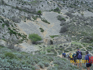
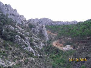
Pla de la Casa circuit from Facega
A straightforward way of visiting one of the Costa Blanca’s highest ridges.
Spanish maps included within these descriptions are provided courtesy of the Spanish IGN and remain © Instituto Geográfico Nacional.
OSM (OpenStreetMap) and OCM (OpenCycleMap) maps are © OpenStreetMap Contributors. The OSM project welcomes contributions from all to enrich the map data, which is made freely available. Land (Thunderforest Landscape) maps are © Thunderforest based on data © OpenStreetMap contributors.
The grade of this walk is S/B, which means
S – Strenuous: More than 600 metres ascent and/or more than 15km in length with steep, loose or heavily vegetated sections.
B – Less than half the route on rough ground.
| Nearest town | Facheca |
| Directions to start |
From Castell de Castells follow the CV720 through Famorca and arrive at Facega. Park along the main road. |
| Start point (Lat/Long) | 38.734402, -0.267976 Click here to view in Google Maps (in a new browser tab) |
| Length (km) | 9.00 |
| Ascent (metres) | 670 |
| Walking time (hours) | 3.33 |
| Total time (hours) | 4.00 |
| Recommendations or Restrictions |
Download walk descriptionDownload GPS file
Comments
Pla de la Casa circuit from Facega — No Comments
HTML tags allowed in your comment: <a href="" title=""> <abbr title=""> <acronym title=""> <b> <blockquote cite=""> <cite> <code> <del datetime=""> <em> <i> <q cite=""> <s> <strike> <strong>