
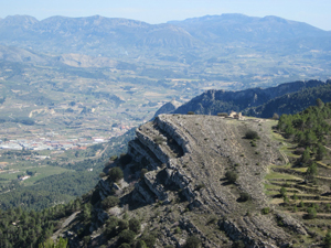
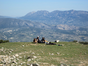
Montcabrer summit and circuit from Cocentaina
A circuit to the highest summit of the Mariola range across wild mountain terrain.
Spanish maps included within these descriptions are provided courtesy of the Spanish IGN and remain © Instituto Geográfico Nacional.
OSM (OpenStreetMap) and OCM (OpenCycleMap) maps are © OpenStreetMap Contributors. The OSM project welcomes contributions from all to enrich the map data, which is made freely available. Land (Thunderforest Landscape) maps are © Thunderforest based on data © OpenStreetMap contributors.
The grade of this walk is VS/B, which means
VS – Very Strenuous: More than 800 metres ascent and/or more than 20km in length with steep, loose or heavily vegetated sections.
B – Less than half the route on rough ground.
| Nearest town | Cocentaina |
| Directions to start |
From the N340 at the south of Cocentaina turn N towards Muro de Alcoy. Go through several roundabouts. When you reach the roundabout with the statues of 3 men and a large rusty bent tower, turn L. (signed) Follow this road steeply uphill and around several zig-zags to arrive at the car parking area for the Ermita. |
| Start point (Lat/Long) | 38.749130, -0.449442 Click here to view in Google Maps (in a new browser tab) |
| Length (km) | 17.00 |
| Ascent (metres) | 1058 |
| Walking time (hours) | 5.00 |
| Total time (hours) | 6.66 |
| Recommendations or Restrictions |
Download walk descriptionDownload GPS file
Comments
Montcabrer summit and circuit from Cocentaina — No Comments
HTML tags allowed in your comment: <a href="" title=""> <abbr title=""> <acronym title=""> <b> <blockquote cite=""> <cite> <code> <del datetime=""> <em> <i> <q cite=""> <s> <strike> <strong>