
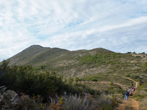
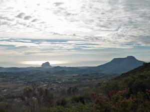
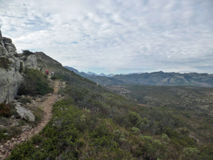
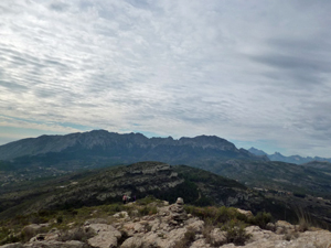
El Cau (Lloma Larga ) figure of 8
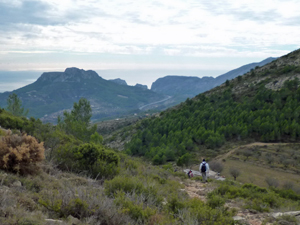
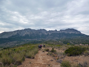
A long ascent to panoramic views of coast and mountains,cross the hemispheres wind round and across the Serra de Bernia and close the ‘8’ on the eastern side of El Cau.
Spanish maps included within these descriptions are provided courtesy of the Spanish IGN and remain © Instituto Geográfico Nacional.
OSM (OpenStreetMap) and OCM (OpenCycleMap) maps are © OpenStreetMap Contributors. The OSM project welcomes contributions from all to enrich the map data, which is made freely available. Land (Thunderforest Landscape) maps are © Thunderforest based on data © OpenStreetMap contributors.
The grade of this walk is VS/B, which means
VS – Very Strenuous: More than 800 metres ascent and/or more than 20km in length with steep, loose or heavily vegetated sections.
B – Less than half the route on rough ground.
| Nearest town | Senija |
| Directions to start |
From N332 Calpe to Benissa take R turn onto CV720 directions Jalon. Park at Km 10 – layby near info/signpost Benissa or El Collado restaurant. |
| Start point (Lat/Long) | 38.722818, 0.027938 Click here to view in Google Maps (in a new browser tab) |
| Length (km) | 18.00 |
| Ascent (metres) | 830 |
| Walking time (hours) | 5.00 |
| Total time (hours) | 6.00 |
| Recommendations or Restrictions | None |
Download walk descriptionDownload GPS file
Comments
El Cau (Lloma Larga ) figure of 8 — No Comments
HTML tags allowed in your comment: <a href="" title=""> <abbr title=""> <acronym title=""> <b> <blockquote cite=""> <cite> <code> <del datetime=""> <em> <i> <q cite=""> <s> <strike> <strong>