
La Pedrissa de Sierra Bernia
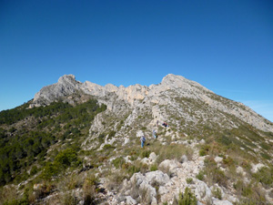
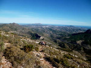
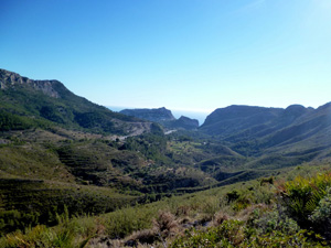
A mountaineer’s day out with a ridge route up the end of the Bernia and panoramic views all around. We cross and recross the Meridian several times in the day!
Spanish maps included within these descriptions are provided courtesy of the Spanish IGN and remain © Instituto Geográfico Nacional.
OSM (OpenStreetMap) and OCM (OpenCycleMap) maps are © OpenStreetMap Contributors. The OSM project welcomes contributions from all to enrich the map data, which is made freely available. Land (Thunderforest Landscape) maps are © Thunderforest based on data © OpenStreetMap contributors.
The grade of this walk is VS/C, which means
VS – Very Strenuous: More than 800 metres ascent and/or more than 20km in length with steep, loose or heavily vegetated sections.
C – More than half the route on rough ground.
| Nearest town | Calpe |
| Directions to start |
Follow the N332 S from Calpe and pass the entrance to the Maryvilla estate on the LHS. At km 165.7 there is a tarmac road on the RHS with signs to Ayuntamiento de Calpe construction project and also their Servicio de Proteccion and Recogido de Animales. Turn R up this road and follow it keeping as close to the motorway on the LHS as you are able. Once you go under the motorway, park where you can on the LHS verge. |
| Start point (Lat/Long) | 38.648170, 0.003840 Click here to view in Google Maps (in a new browser tab) |
| Length (km) | 11.00 |
| Ascent (metres) | 820 |
| Walking time (hours) | 3.50 |
| Total time (hours) | 5.00 |
| Recommendations or Restrictions | Ability to cope with rocky ground and navigational ability required for this route. |
Download walk descriptionDownload GPS file
Comments
La Pedrissa de Sierra Bernia — No Comments
HTML tags allowed in your comment: <a href="" title=""> <abbr title=""> <acronym title=""> <b> <blockquote cite=""> <cite> <code> <del datetime=""> <em> <i> <q cite=""> <s> <strike> <strong>