
A circuit over Solana del Garrofer
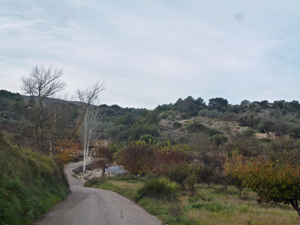
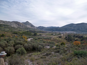
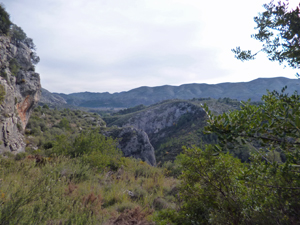
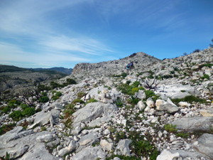
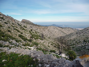
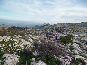
A rewarding walk mainly on marked or well used paths and a little on a quiet country road. There is a little “off-piste” but this is good underfoot and not scratchy. A must for the views.
Spanish maps included within these descriptions are provided courtesy of the Spanish IGN and remain © Instituto Geográfico Nacional.
OSM (OpenStreetMap) and OCM (OpenCycleMap) maps are © OpenStreetMap Contributors. The OSM project welcomes contributions from all to enrich the map data, which is made freely available. Land (Thunderforest Landscape) maps are © Thunderforest based on data © OpenStreetMap contributors.
The grade of this walk is S/B, which means
S – Strenuous: More than 600 metres ascent and/or more than 15km in length with steep, loose or heavily vegetated sections.
B – Less than half the route on rough ground.
| Nearest town | Vall d’Ebo |
| Directions to start |
From the CV 715 Orba to Pego road – SE of Pego take the CV712 to Vall d’Ebo. As you approach Vall d’Ebo go over the bridge, straight on and park at the edge of the village. |
| Start point (Lat/Long) | 38.806654, -0.157279 Click here to view in Google Maps (in a new browser tab) |
| Length (km) | 15.50 |
| Ascent (metres) | 680 |
| Walking time (hours) | 4.50 |
| Total time (hours) | 6.00 |
| Recommendations or Restrictions | Avoid during olive harvest – Nov. and Dec. |
Download walk descriptionDownload GPS file
Comments
A circuit over Solana del Garrofer — No Comments
HTML tags allowed in your comment: <a href="" title=""> <abbr title=""> <acronym title=""> <b> <blockquote cite=""> <cite> <code> <del datetime=""> <em> <i> <q cite=""> <s> <strike> <strong>