
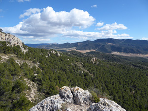
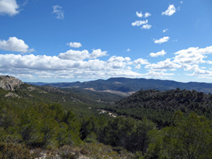
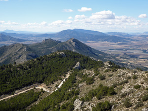
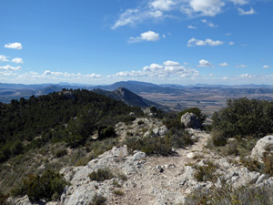
Serra del Frare
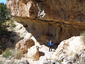
A circular walk following PRCV 155 on well marked, defined paths and forestry tracks. The route follows two high ridges and offers stunning scenery. Some of the inclines are steep and stoney
Spanish maps included within these descriptions are provided courtesy of the Spanish IGN and remain © Instituto Geográfico Nacional.
OSM (OpenStreetMap) and OCM (OpenCycleMap) maps are © OpenStreetMap Contributors. The OSM project welcomes contributions from all to enrich the map data, which is made freely available. Land (Thunderforest Landscape) maps are © Thunderforest based on data © OpenStreetMap contributors.
The grade of this walk is S/B, which means
S – Strenuous: More than 600 metres ascent and/or more than 15km in length with steep, loose or heavily vegetated sections.
B – Less than half the route on rough ground.
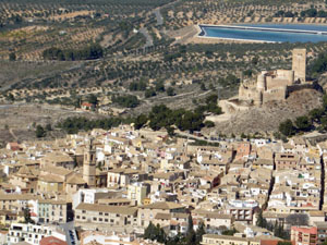
| Nearest town | Biar |
| Directions to start |
On entering Biar from Ibi on CV 799 the road turns sharply left then goes downhill passing the centres of commerce. At the bottom the road turns sharply right. Turn left here (there is a sign for “La Corona” restaurant and supermarket Hiperber on the corner) Follow the road (Calle Navarra) until the asphalt stops and park on the levelled ground on the right |
| Start point (Lat/Long) | 38.619000, -0.762000 Click here to view in Google Maps (in a new browser tab) |
| Length (km) | 12.00 |
| Ascent (metres) | 700 |
| Walking time (hours) | 4.5 |
| Total time (hours) | 4.50 |
| Recommendations or Restrictions | None. When walked in March 2016 none of the springs (fuentes) had running water so make sure you carry enough water for the whole route. |
Download walk descriptionDownload GPS file
Comments
Serra del Frare — No Comments
HTML tags allowed in your comment: <a href="" title=""> <abbr title=""> <acronym title=""> <b> <blockquote cite=""> <cite> <code> <del datetime=""> <em> <i> <q cite=""> <s> <strike> <strong>