
The Vallfiguera Gubies
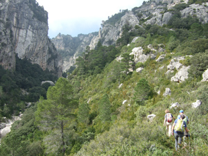
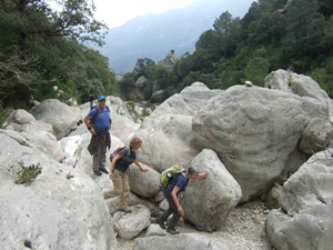
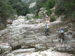
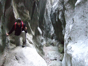
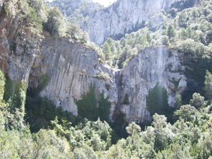
This dramatic circular route visits the narrows (Gubies in Catalan) of the Vallfiguera’s steep ravine. This magnificent water-sculpted rockscape is normally only accessible to canyoners who can negotiate the 14 abseils (wet and dry) and awkward climbing of the 3.5km barranc.
Spanish maps included within these descriptions are provided courtesy of the Spanish IGN and remain © Instituto Geográfico Nacional.
OSM (OpenStreetMap) and OCM (OpenCycleMap) maps are © OpenStreetMap Contributors. The OSM project welcomes contributions from all to enrich the map data, which is made freely available. Land (Thunderforest Landscape) maps are © Thunderforest based on data © OpenStreetMap contributors.
The grade of this walk is S/B, which means
S – Strenuous: More than 600 metres ascent and/or more than 15km in length with steep, loose or heavily vegetated sections.
B – Less than half the route on rough ground.
| Nearest town | Toscar |
| Directions to start |
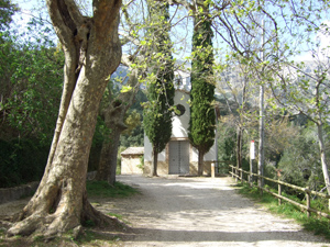
Take the T-341 west from Tortosa through Roquetes, in the direction of of els Reguers and Alfara de Carles. Some 7km beyond els Reguers the road takes a sweeping turn to the right. Take the left turn at the apex of this bend and, after a further 4.5km, enter the hamlet of Toscar. The parking place is immediately below an electricity substation and has some prominent els Ports information boards. |
| Start point (Lat/Long) | 40.846306, 0.354139 Click here to view in Google Maps (in a new browser tab) |
| Length (km) | 10.60 |
| Ascent (metres) | 603 |
| Walking time (hours) | 5.50 |
| Total time (hours) | 7.00 |
| Recommendations or Restrictions | This route should never be undertaken after heavy rain. Times assume you are making the worthwhile diversion into the Gubies (narrows). |
Download walk descriptionDownload GPS file
Comments
The Vallfiguera Gubies — No Comments
HTML tags allowed in your comment: <a href="" title=""> <abbr title=""> <acronym title=""> <b> <blockquote cite=""> <cite> <code> <del datetime=""> <em> <i> <q cite=""> <s> <strike> <strong>