
Collbato circuit
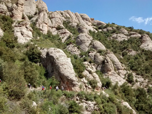
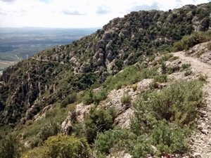
A strenuous ascent to the Ermita de Sant Joan followed by an easier descent past the funicular station and the down a delightful track – Cami Vell de Collbato to return to the village.
Spanish maps included within these descriptions are provided courtesy of the Spanish IGN and remain © Instituto Geográfico Nacional.
OSM (OpenStreetMap) and OCM (OpenCycleMap) maps are © OpenStreetMap Contributors. The OSM project welcomes contributions from all to enrich the map data, which is made freely available. Land (Thunderforest Landscape) maps are © Thunderforest based on data © OpenStreetMap contributors.
The grade of this walk is S/B, which means
S – Strenuous: More than 600 metres ascent and/or more than 15km in length with steep, loose or heavily vegetated sections.
B – Less than half the route on rough ground.
| Nearest town | Collbato |
| Directions to start |
Follow the A2 to the N of Barcelona and take exit 576A. Pass the village of Collbato on the B112 towards Montserrat and look out for a sign to the L towards the Coves de Collbato. Follow this lane for 200m and park in the large open area on the LHS just above the picnic area. |
| Start point (Lat/Long) | 41.572556, 1.828668 Click here to view in Google Maps (in a new browser tab) |
| Length (km) | 13.00 |
| Ascent (metres) | 770 |
| Walking time (hours) | 3.50 |
| Total time (hours) | 5.75 |
| Recommendations or Restrictions | None |
Download walk descriptionDownload GPS file
Comments
Collbato circuit — No Comments
HTML tags allowed in your comment: <a href="" title=""> <abbr title=""> <acronym title=""> <b> <blockquote cite=""> <cite> <code> <del datetime=""> <em> <i> <q cite=""> <s> <strike> <strong>