
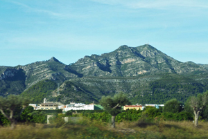
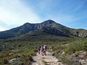
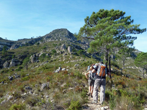
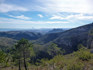
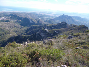
Montduver circuit
A route up to the summit of this attractive mountain and then along its flanks taking in some picturesque scenery along ridge and via fonts.
Spanish maps included within these descriptions are provided courtesy of the Spanish IGN and remain © Instituto Geográfico Nacional.
OSM (OpenStreetMap) and OCM (OpenCycleMap) maps are © OpenStreetMap Contributors. The OSM project welcomes contributions from all to enrich the map data, which is made freely available. Land (Thunderforest Landscape) maps are © Thunderforest based on data © OpenStreetMap contributors.
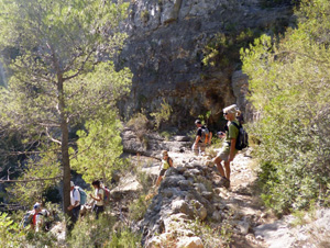
The grade of this walk is VS/B/Scr, which means
VS – Very Strenuous: More than 800 metres ascent and/or more than 20km in length with steep, loose or heavily vegetated sections.
B – Less than half the route on rough ground.
Scr – Scrambling: This implies the need for handholds to ascend steep rock pitches with a sense of exposure to vertigo and where a slip could lead to a serious accident.
| Nearest town | Xeraco |
| Directions to start |
At km 231.2 on the N332 going N look for a Patri supermarket on the RHS. Take the next turning L into a campo road and follow this over the motorway and up into the valley until just before the tarmac ends where there is parking in front of a ruin on the LHS. |
| Start point (Lat/Long) | 39.021034, -0.252567 Click here to view in Google Maps (in a new browser tab) |
| Length (km) | 16.00 |
| Ascent (metres) | 900 |
| Walking time (hours) | 4.25 |
| Total time (hours) | 5.5 |
| Recommendations or Restrictions | Done this way around the scrambles early in the day are quite easy to deal with with minimal exposure. |
Download walk descriptionDownload GPS file
Comments
Montduver circuit — No Comments
HTML tags allowed in your comment: <a href="" title=""> <abbr title=""> <acronym title=""> <b> <blockquote cite=""> <cite> <code> <del datetime=""> <em> <i> <q cite=""> <s> <strike> <strong>