
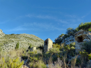
Segaria western exploration
A very pleasant walk for the main part around this rugged mountain with a tough ascent over rocky ground to the summit. A little scrambling.
Spanish maps included within these descriptions are provided courtesy of the Spanish IGN and remain © Instituto Geográfico Nacional.
OSM (OpenStreetMap) and OCM (OpenCycleMap) maps are © OpenStreetMap Contributors. The OSM project welcomes contributions from all to enrich the map data, which is made freely available. Land (Thunderforest Landscape) maps are © Thunderforest based on data © OpenStreetMap contributors.
The grade of this walk is M/B, which means
M – Moderate: up to 12km in length, less than 400 metres ascent and less than 50% rough going.
B – Less than half the route on rough ground
| Nearest town | Benimeli |
| Directions to start |
Take the CV729 to Benimeli. In centre of Benimeli turn off the CV729 following brown sign “Pou de Baix”. Park near outdoor piscina. |
| Start point (Lat/Long) | 38.820390, -0.043004 Click here to view in Google Maps (in a new browser tab) |
| Length (km) | 7.00 |
| Ascent (metres) | 400 |
| Walking time (hours) | 2 |
| Total time (hours) | 2.5 |
| Recommendations or Restrictions | None |
Download walk descriptionDownload GPS file
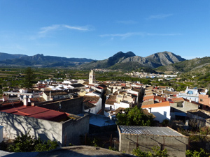
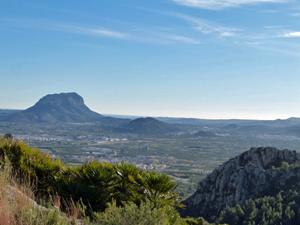
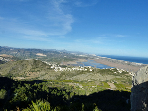
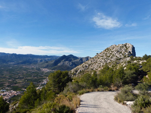
We did this walk about 3 months ago. The ascent was not too difficult – the descent we found a bit trickier. Great views from the top!