
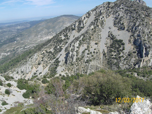
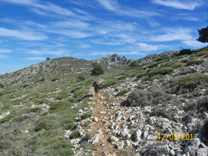
Serrella and Pla de la Casa
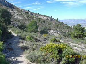
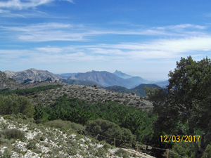
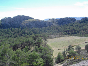
A walk to the summit of the Serella ridge (1359m) and along to a more dramatic near neighbour – Pla de la Casa. Fabulous scenery all day long.
Spanish maps included within these descriptions are provided courtesy of the Spanish IGN and remain © Instituto Geográfico Nacional.
OSM (OpenStreetMap) and OCM (OpenCycleMap) maps are © OpenStreetMap Contributors. The OSM project welcomes contributions from all to enrich the map data, which is made freely available. Land (Thunderforest Landscape) maps are © Thunderforest based on data © OpenStreetMap contributors.
The grade of this walk is VS/B, which means
VS – Very Strenuous: More than 800 metres ascent and/or more than 20km in length with steep, loose or heavily vegetated sections.
B – Less than half the route on rough ground.
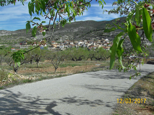
| Nearest town | Facheca |
| Directions to start |
Follow the CV720 from Pedreguer near the coast through Alcalali, Benichembla and Castell de Castells to finally arrive at Facheca. |
| Start point (Lat/Long) | 38.734468, -0.268056 Click here to view in Google Maps (in a new browser tab) |
| Length (km) | 14.50 |
| Ascent (metres) | 940 |
| Walking time (hours) | 4.25 |
| Total time (hours) | 5.75 |
| Recommendations or Restrictions | None |
Download walk descriptionDownload GPS file
Comments
Serrella and Pla de la Casa — No Comments
HTML tags allowed in your comment: <a href="" title=""> <abbr title=""> <acronym title=""> <b> <blockquote cite=""> <cite> <code> <del datetime=""> <em> <i> <q cite=""> <s> <strike> <strong>