
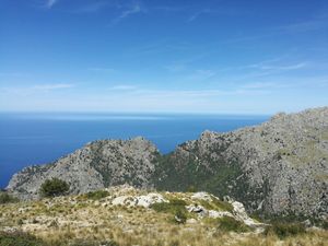
Fornalutz – Puig de sa Bassa
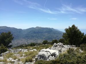
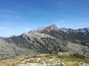
Pleasant walk up a wooded valley to a viewpoint with great views, and then on up to the peak with spectacular views all round. Return via a more open path, with views towards the mountains inland.
Spanish maps included within these descriptions are provided courtesy of the Spanish IGN and remain © Instituto Geográfico Nacional.
OSM (OpenStreetMap) and OCM (OpenCycleMap) maps are © OpenStreetMap Contributors. The OSM project welcomes contributions from all to enrich the map data, which is made freely available. Land (Thunderforest Landscape) maps are © Thunderforest based on data © OpenStreetMap contributors.
The grade of this walk is S/B, which means
S – Strenuous: More than 600 metres ascent and/or more than 15km in length with steep, loose or heavily vegetated sections.
B – Less than half the route on rough ground.
| Nearest town | Fornalutz |
| Directions to start |
If coming by car, park in the car park off the Ma-2120 to the NE of the town centre, and walk the 100m or so down to the square. |
| Start point (Lat/Long) | 39.782425, 2.740956 Click here to view in Google Maps (in a new browser tab) |
| Length (km) | 9.10 |
| Ascent (metres) | 633 |
| Walking time (hours) | 4 |
| Total time (hours) | 4.5 |
| Recommendations or Restrictions | The area above the Ma-10 (between points C and F) is an area where there are danger signs “Perill Arm de Foc” – danger firearms, and to enter it you go through a gate warning of big game hunting there. |
Download walk descriptionDownload GPS file
Comments
Fornalutz – Puig de sa Bassa — No Comments
HTML tags allowed in your comment: <a href="" title=""> <abbr title=""> <acronym title=""> <b> <blockquote cite=""> <cite> <code> <del datetime=""> <em> <i> <q cite=""> <s> <strike> <strong>