
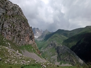
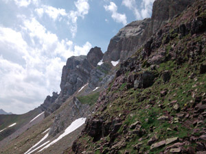
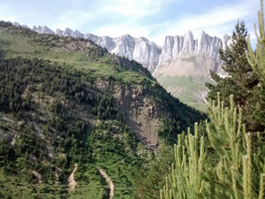
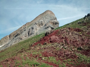
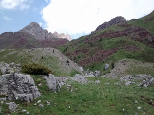
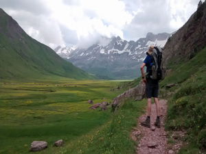
GR11 – Day 12 From Zuriza to wild camp either at La Mina or – better – at Aquas Tuertas.
Almost the whole day is spent in open countryside with mountain scenery, a high pass and demanding terrain.
Spanish maps included within these descriptions are provided courtesy of the Spanish IGN and remain © Instituto Geográfico Nacional.
OSM (OpenStreetMap) and OCM (OpenCycleMap) maps are © OpenStreetMap Contributors. The OSM project welcomes contributions from all to enrich the map data, which is made freely available. Land (Thunderforest Landscape) maps are © Thunderforest based on data © OpenStreetMap contributors.
The grade of this walk is VS/A, which means
VS – Very Strenuous: More than 800 metres ascent and/or more than 20km in length with steep, loose or heavily vegetated sections.
A – All on good tracks
| Nearest town | Zuriza |
| Directions to start |
From the N240 E-W road from Pamplona take the A1602 N to Anso and from here follow a minor road N through the Veral gorge to reach Camping Zuriza. |
| Start point (Lat/Long) | 42.864677, -0.813231 Click here to view in Google Maps (in a new browser tab) |
| Length (km) | 20.00 |
| Ascent (metres) | 1220 |
| Walking time (hours) | 6.25 |
| Total time (hours) | 8.75 |
| Recommendations or Restrictions | None |
Download walk descriptionDownload GPS file
Comments
GR11 – Day 12 From Zuriza to wild camp either at La Mina or – better – at Aquas Tuertas. — No Comments
HTML tags allowed in your comment: <a href="" title=""> <abbr title=""> <acronym title=""> <b> <blockquote cite=""> <cite> <code> <del datetime=""> <em> <i> <q cite=""> <s> <strike> <strong>