
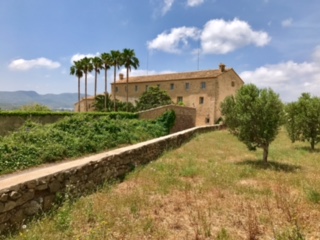
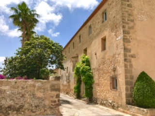
Jesus Pobre Circuit of Antiquity
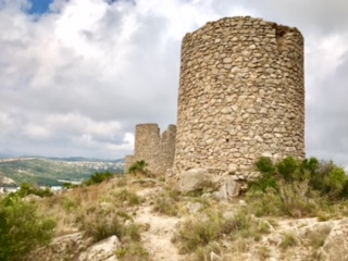
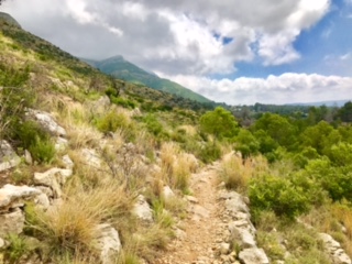
Mostly paths and tracks, through attractive countryside, via several locations of antiquarian interest. With short steep ascents to the Molins and up slopes below Coll de Pous. The descent from the Molins is steep, with awkward steps down bancals, over rough and sometimes scratchy terrain!
Spanish maps included within these descriptions are provided courtesy of the Spanish IGN and remain © Instituto Geográfico Nacional.
OSM (OpenStreetMap) and OCM (OpenCycleMap) maps are © OpenStreetMap Contributors. The OSM project welcomes contributions from all to enrich the map data, which is made freely available. Land (Thunderforest Landscape) maps are © Thunderforest based on data © OpenStreetMap contributors.
The grade of this walk is M/C, which means
M – Moderate: up to 12km in length, less than 400 metres ascent and less than 50% rough going.
C – More than half the route on rough ground
| Nearest town | Jesus Pobre |
| Directions to start |
From CV-738 at the edge of the village, turn into Calle Pare Pere opposite the buildings of the Sabadell Solbank. Go up it past a square on L into the Calle Major, turn first L into Calle Atmetllers, then L at junction into Calle Pinaret. Park on side of road or gravel car park on R. |
| Start point (Lat/Long) | 38.798000, 0.083000 Click here to view in Google Maps (in a new browser tab) |
| Length (km) | 9.00 |
| Ascent (metres) | 210 |
| Walking time (hours) | 2.33 |
| Total time (hours) | 4 |
| Recommendations or Restrictions | A reasonable level of agility is required for the descent from the Molins, where also concentration is required for the complex route finding! Some sections will be muddy after wet weather. |
Download walk descriptionDownload GPS file
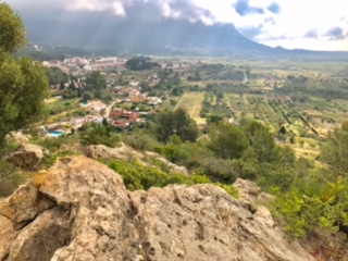
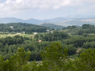
Very good walk. Great views.