
Marnes Circuit Anticlockwise
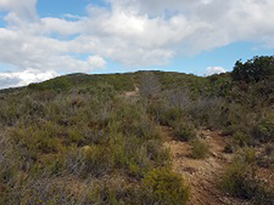
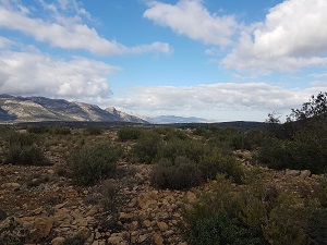
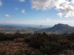
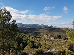
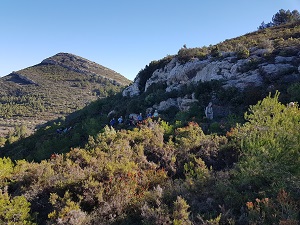
After a steep initial climb the path undulates up to the Col under the Cao summit. Views along the way are of the coast down to Calpe and then 360 to the Bernia ridge.
Spanish maps included within these descriptions are provided courtesy of the Spanish IGN and remain © Instituto Geográfico Nacional.
OSM (OpenStreetMap) and OCM (OpenCycleMap) maps are © OpenStreetMap Contributors. The OSM project welcomes contributions from all to enrich the map data, which is made freely available. Land (Thunderforest Landscape) maps are © Thunderforest based on data © OpenStreetMap contributors.
The grade of this walk is M/B, which means
M – Moderate: up to 12km in length, less than 400 metres ascent and less than 50% rough going.
B – Less than half the route on rough ground
| Nearest town | Pinos |
| Directions to start |
From Benissa head South on CV332. 0.5km after leaving Benissa turn R and follow signs to CV749 to Pinos & Bernia. Take care while crossing CV 750 and then continue up narrow bendy road to Pinos. Turn R just after bridge 1km after passing Restaurant Pinos and park on the R at the junction. If there is not enough space continue up the road to Marnes and park at the side of the road or at the car park on the LHS after 200M. |
| Start point (Lat/Long) | 38.678140, -0.017280 Click here to view in Google Maps (in a new browser tab) |
| Length (km) | 9.50 |
| Ascent (metres) | 390 |
| Walking time (hours) | 3 |
| Total time (hours) | 4 |
| Recommendations or Restrictions | If walking as a group, leaders should park near the bridge to capture fellow walkers as they go past. Distances are from the upper car park. |
Download walk descriptionDownload GPS file
We did this beautiful walk without the usual support of our Garmin and tried to follow the descriptions . They were too vague and unclear. Indications are very ambiguous. We lost track several times and ended up walking the last few km on asphalts. Our recommendation: be extremely well prepared if you cannot download the track and be willing to stop various times to check and look, walk back. Calculate extra time. Even then you might get lost, we hope that we will be able to redo the walk again with our garmin I ASAP.