
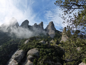
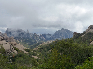
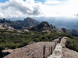
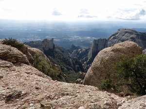
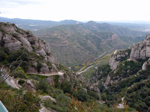
Miranda de Sant Jeroni
A delightful walk up the highest point within the park and around some of the rocky promontories that abound here.
Spanish maps included within these descriptions are provided courtesy of the Spanish IGN and remain © Instituto Geográfico Nacional.
OSM (OpenStreetMap) and OCM (OpenCycleMap) maps are © OpenStreetMap Contributors. The OSM project welcomes contributions from all to enrich the map data, which is made freely available. Land (Thunderforest Landscape) maps are © Thunderforest based on data © OpenStreetMap contributors.
The grade of this walk is S/A, which means
S – Strenuous: More than 600 metres ascent and/or more than 15km in length with steep, loose or heavily vegetated sections.
A – All good tracks.
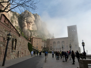
| Nearest town | Monistrol de Montserrat |
| Directions to start |
From anywhere near Barcelona take the A2 in the direction of Igualada and Lleida and leave this on the C55 at junction 582A heading N. Continue to arrive at Monistrol de Montserrat where you take the BP1121 towards the Monasterio de Montserrat. Wind up this road past a junction to reach the barriers to the Monastery. If you proceed past here you will have pay for parking. Either way, continue walking ahead towards the Monastery until you reach the plaza with the fountain and the garden. |
| Start point (Lat/Long) | 41.592049, 1.835490 Click here to view in Google Maps (in a new browser tab) |
| Length (km) | 10.50 |
| Ascent (metres) | 680 |
| Walking time (hours) | 3.25 |
| Total time (hours) | 5.25 |
| Recommendations or Restrictions | None |
Download walk descriptionDownload GPS file
Comments
Miranda de Sant Jeroni — No Comments
HTML tags allowed in your comment: <a href="" title=""> <abbr title=""> <acronym title=""> <b> <blockquote cite=""> <cite> <code> <del datetime=""> <em> <i> <q cite=""> <s> <strike> <strong>