
Pauls circuit to Punta de l’Aigua
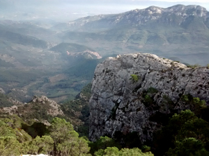
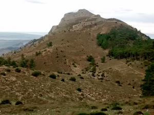
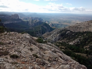
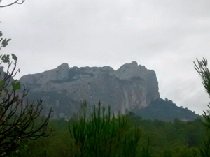
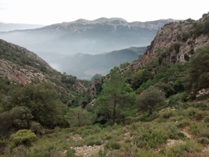
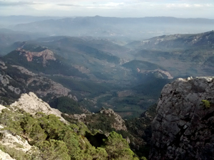
A gentle beginning leads to a stiff climb up to the ridge and then an exploration of the ridge line follows before descending back to the village. Great views all day and fascinating terrain.
Spanish maps included within these descriptions are provided courtesy of the Spanish IGN and remain © Instituto Geográfico Nacional.
OSM (OpenStreetMap) and OCM (OpenCycleMap) maps are © OpenStreetMap Contributors. The OSM project welcomes contributions from all to enrich the map data, which is made freely available. Land (Thunderforest Landscape) maps are © Thunderforest based on data © OpenStreetMap contributors.
The grade of this walk is VS/B, which means
VS – Very Strenuous: More than 800 metres ascent and/or more than 20km in length with steep, loose or heavily vegetated sections.
B – Less than half the route on rough ground.
| Nearest town | Pauls |
| Directions to start |
Above village, near to cemetery |
| Start point (Lat/Long) | 40.922647, 0.397622 Click here to view in Google Maps (in a new browser tab) |
| Length (km) | 14.00 |
| Ascent (metres) | 950 |
| Walking time (hours) | 4 |
| Total time (hours) | 6 |
| Recommendations or Restrictions | A head for heights is required to make the optional excursion to the summit of Punta de l’Aigua. |
Download walk descriptionDownload GPS file
Comments
Pauls circuit to Punta de l’Aigua — No Comments
HTML tags allowed in your comment: <a href="" title=""> <abbr title=""> <acronym title=""> <b> <blockquote cite=""> <cite> <code> <del datetime=""> <em> <i> <q cite=""> <s> <strike> <strong>