
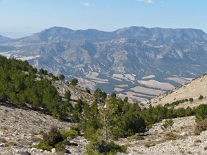
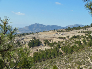
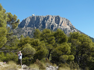
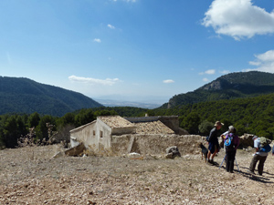
Pedro Lopez Circuit from Collado Mangueta
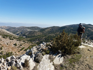
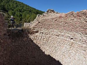
An excellent walk on good tracks and paths with some terrific views. Interesting ruins of a group of 7 neveras. An absolute must.
Spanish maps included within these descriptions are provided courtesy of the Spanish IGN and remain © Instituto Geográfico Nacional.
OSM (OpenStreetMap) and OCM (OpenCycleMap) maps are © OpenStreetMap Contributors. The OSM project welcomes contributions from all to enrich the map data, which is made freely available. Land (Thunderforest Landscape) maps are © Thunderforest based on data © OpenStreetMap contributors.
The grade of this walk is VS/A, which means
VS – Very Strenuous: More than 800 metres ascent and/or more than 20km in length with steep, loose or heavily vegetated sections.
A – All on good tracks
| Nearest town | El Berro |
| Directions to start |
Turn R out of campsite (in car!) then after 2.2km (1.4miles) go R at T junction. After another 3 km (1.9miles) turn next R to La Perdiz. Continue for 3.4km (2.1miles) to next T junction and turn R. Continue for a further 5.9km (3.7miles) to Collado Bermejo, take sharp R and another 3 km (1.9miles) brings you to Collado Mangueta which is your starting point. |
| Start point (Lat/Long) | 37.869394, -1.567551 Click here to view in Google Maps (in a new browser tab) |
| Length (km) | 17.00 |
| Ascent (metres) | 830 |
| Walking time (hours) | 4.00 |
| Total time (hours) | 6.00 |
| Recommendations or Restrictions | None |
Download walk descriptionDownload GPS file
Comments
Pedro Lopez Circuit from Collado Mangueta — No Comments
HTML tags allowed in your comment: <a href="" title=""> <abbr title=""> <acronym title=""> <b> <blockquote cite=""> <cite> <code> <del datetime=""> <em> <i> <q cite=""> <s> <strike> <strong>