
Portell de Migdia and Collado de Porc
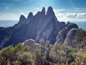
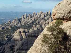
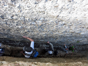
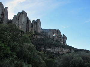
A an extremely demanding day out with challenging scrambling with heady exposure – fantastic fun for those with a good head for heights. Miserable for those without. Wind in and through some of the rocky spires of Montserrat before descending on good trails and 1-2 km of road at the end to rest the legs.
Spanish maps included within these descriptions are provided courtesy of the Spanish IGN and remain © Instituto Geográfico Nacional.
OSM (OpenStreetMap) and OCM (OpenCycleMap) maps are © OpenStreetMap Contributors. The OSM project welcomes contributions from all to enrich the map data, which is made freely available. Land (Thunderforest Landscape) maps are © Thunderforest based on data © OpenStreetMap contributors.
The grade of this walk is S/C/Scr/X, which means
S – Strenuous: More than 600 metres ascent and/or more than 15km in length with steep, loose or heavily vegetated sections.
C – More than half the route on rough ground.
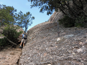
Scr – Scrambling: This implies the need for handholds to ascend steep rock pitches with a sense of exposure to vertigo and where a slip could lead to a serious accident.
X – Experienced walkers route: the route requires considerable stamina and/or significant scrambling skills on rough, steep or exposed sections.
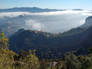
| Nearest town | Monistrol de Montserrat |
| Directions to start |
From anywhere near Barcelona take the A2 in the direction of Igualada and Lleida and leave this on the C55 at junction 582A heading N. Continue to arrive at Monistrol de Montserrat where you take the BP1121 towards the Monasterio de Montserrat. Wind up this road for several km and turn R at a junction (signed Barcelona N11) and pass through a tunnel before finding the Ermita de Santa Cecilia on the RHS. Park here. |
| Start point (Lat/Long) | 41.611000, 1.816760 Click here to view in Google Maps (in a new browser tab) |
| Length (km) | 9.00 |
| Ascent (metres) | 700 |
| Walking time (hours) | 3.00 |
| Total time (hours) | 5.50 |
| Recommendations or Restrictions | For those with a good head for heights, an ability to navigate and mountaineering experience! |
Download walk descriptionDownload GPS file
Although at times difficult to follow the GPS in the channels, it’s an excellent route. Thanks for sharing it!