
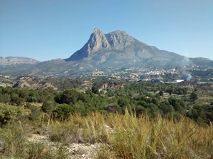
Sierra de Orxeta
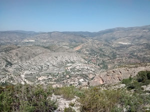
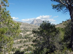
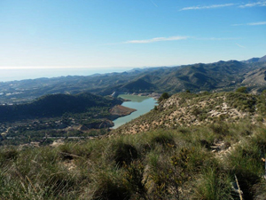
A long steep early ascent is rewarded along one of the longest ridges on the Costa Blanca with spectacular and extensive views of coast and mountains.
Spanish maps included within these descriptions are provided courtesy of the Spanish IGN and remain © Instituto Geográfico Nacional.
OSM (OpenStreetMap) and OCM (OpenCycleMap) maps are © OpenStreetMap Contributors. The OSM project welcomes contributions from all to enrich the map data, which is made freely available. Land (Thunderforest Landscape) maps are © Thunderforest based on data © OpenStreetMap contributors.
The grade of this walk is VS/B, which means
VS – Very Strenuous: More than 800 metres ascent and/or more than 20km in length with steep, loose or heavily vegetated sections.
B – Less than half the route on rough ground.
| Nearest town | Finestrat |
| Directions to start |
CV767 Benidorm to Finestrat road , at the large roundabout just before Finestrat turn L on CV759 direction Vila Joiosa, immediately before KM 5 turn R up narrow surfaced road, follow for 2.3 kms and park on open ground near large pylon. |
| Start point (Lat/Long) | 38.555650, -0.217730 Click here to view in Google Maps (in a new browser tab) |
| Length (km) | 16.00 |
| Ascent (metres) | 860 |
| Walking time (hours) | 4.5 |
| Total time (hours) | 5.33 |
| Recommendations or Restrictions | An exceptionally long and tough early ascent. |
Download walk descriptionDownload GPS file
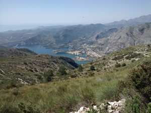
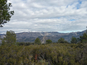
We have just done this route (27 March 2019) and enjoyed it, especially the return over the lower hills in the south. The views from the summit trig point are worth the continuous ascent.